Geolocate

Castelvecchio topographic map

Click on the map to display elevation.

About this map

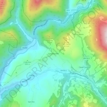
Name: Castelvecchio topographic map, elevation, terrain.

Location: Castelvecchio, Preci, Perugia, Umbria, 06047, Italy (42.87087 13.00096 42.91087 13.04096)

Average elevation: 626 m

Minimum elevation: 450 m

Maximum elevation: 1,095 m

Gear up for your next adventure:

Bushcraft Tarp - Versatile emergency shelter or gear protection
🥾Mountain Hiking Boots - High-traction boots for rocky terrain
🐕Hiking Dog Pack - Let your canine companion carry their own water and food
💡Compact LED Flashlight - Powerful and portable flashlight for outdoor use
🌡️Emergency Mylar Blankets - Compact thermal protection for unexpected nights outdoors

As an Amazon Associate, this site earns from qualifying purchases at no extra cost to you.