
Thank you for supporting this site ❤️
Make a donation
Make a donation
Gear up for your next adventure:
As an Amazon Associate, this site earns from qualifying purchases at no extra cost to you.
Quillacas topographic map
Click on the map to display elevation.
Thank you for supporting this site ❤️
Make a donation
Make a donation
Gear up for your next adventure:
As an Amazon Associate, this site earns from qualifying purchases at no extra cost to you.
About this map
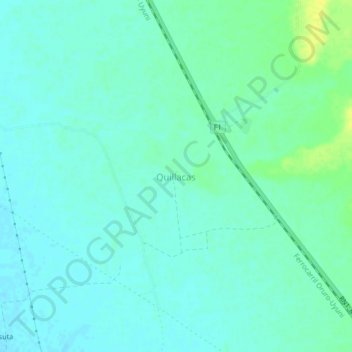
Name: Quillacas topographic map, elevation, terrain.
Location: Quillacas, Challapata, Eduardo Abaroa, Oruro, Bolivia (-18.87786 -66.83642 -18.83786 -66.79642)
Average elevation: 3,701 m
Minimum elevation: 3,695 m
Maximum elevation: 3,715 m
Thank you for supporting this site ❤️
Make a donation
Make a donation
Gear up for your next adventure:
As an Amazon Associate, this site earns from qualifying purchases at no extra cost to you.