
Thank you for supporting this site ❤️
Make a donation
Make a donation
Gear up for your next adventure:
As an Amazon Associate, this site earns from qualifying purchases at no extra cost to you.
Collistano topographic map
Click on the map to display elevation.
Thank you for supporting this site ❤️
Make a donation
Make a donation
Gear up for your next adventure:
As an Amazon Associate, this site earns from qualifying purchases at no extra cost to you.
About this map
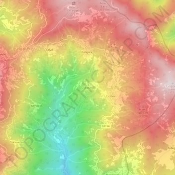
Name: Collistano topographic map, elevation, terrain.
Location: Collistano, Colleri, Brallo di Pregola, Pavia, Lombardia, Italia (44.70921 9.28118 44.74921 9.32118)
Average elevation: 890 m
Minimum elevation: 506 m
Maximum elevation: 1,158 m
Thank you for supporting this site ❤️
Make a donation
Make a donation
Gear up for your next adventure:
As an Amazon Associate, this site earns from qualifying purchases at no extra cost to you.