
Thank you for supporting this site ❤️
Make a donation
Make a donation
Gear up for your next adventure:
As an Amazon Associate, this site earns from qualifying purchases at no extra cost to you.
Heol-fanog topographic map
Click on the map to display elevation.
Thank you for supporting this site ❤️
Make a donation
Make a donation
Gear up for your next adventure:
As an Amazon Associate, this site earns from qualifying purchases at no extra cost to you.
About this map
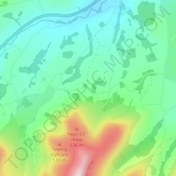
Name: Heol-fanog topographic map, elevation, terrain.
Location: Heol-fanog, Glyn Tarell, Powys, Wales, LD3 8LE, United Kingdom (51.89692 -3.44590 51.93692 -3.40590)
Average elevation: 296 m
Minimum elevation: 151 m
Maximum elevation: 690 m
Thank you for supporting this site ❤️
Make a donation
Make a donation
Gear up for your next adventure:
As an Amazon Associate, this site earns from qualifying purchases at no extra cost to you.
Other topographic maps
Click on a map to view its topography, its elevation and its terrain.