Geolocate

sa Pobla topographic map

Click on the map to display elevation.

About this map

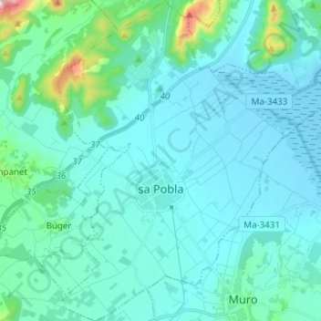
Name: sa Pobla topographic map, elevation, terrain.

Location: sa Pobla, Raiguer, Balearic Islands, 07420, Spain (39.73061 2.98526 39.82580 3.09244)

Average elevation: 52 m

Minimum elevation: -3 m

Maximum elevation: 447 m

Other topographic maps

Click on a map to view its topography, its elevation and its terrain.

Gear up for your next adventure:

Family Camping Tent - Spacious tent suitable for family camping trips
Camping Coffee Maker - Brew fresh coffee anywhere on the topographic map
🧴Insect Repellent - Protect yourself from bugs during outdoor adventures
🔪Outdoor Multitool - Versatile tool for repairs and food prep in the wild
🌬️Windproof Camp Stove - Efficient cooking even on exposed mountain peaks

As an Amazon Associate, this site earns from qualifying purchases at no extra cost to you.