Geolocate

Guaranda topographic map

Click on the map to display elevation.

About this map

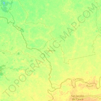
Name: Guaranda topographic map, elevation, terrain.

Location: Guaranda, La Mojana, Sucre, Colombia (8.27605 -74.83933 8.51010 -74.53289)

Average elevation: 23 m

Minimum elevation: 11 m

Maximum elevation: 34 m

Gear up for your next adventure:

🥾Mountain Trail Shoes - High-traction shoes for mountain trails
🥾Approach Shoes - Shoes designed for climbing approaches and rugged trails
🎒Hiking Daypack - Lightweight and durable backpacks for day trips and excursions
🥾Trekking Boots - Durable boots for long-distance trekking
🧢Beanie Hat - Keep your head warm in cold weather

As an Amazon Associate, this site earns from qualifying purchases at no extra cost to you.