Geolocate

Alpnachstad topographic map

Click on the map to display elevation.

About this map

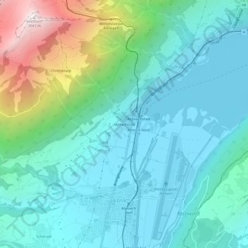
Name: Alpnachstad topographic map, elevation, terrain.

Location: Alpnachstad, Alpnach, Obwalden, 6053, Switzerland (46.93342 8.25434 46.97342 8.29434)

Average elevation: 765 m

Minimum elevation: 422 m

Maximum elevation: 2,031 m

Gear up for your next adventure:

👟Leg Gaiters - Keep debris, mud, and snow out of your boots
🚲Bike Repair Kit - Essential tools for on-trail mechanical issues
🥾Trail Hiking Socks - Comfortable socks to prevent blisters and fatigue
🔪Outdoor Multitool - Versatile tool for repairs and food prep in the wild
🦶Anti-Blister Balm - Prevents friction and hotspots during long ascents

As an Amazon Associate, this site earns from qualifying purchases at no extra cost to you.