Geolocate

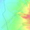
Baladiya topographic map

Click on the map to display elevation.

About this map

Name: Baladiya topographic map, elevation, terrain.

Location: Baladiya, Bhuj Taluka, Kachchh, Gujarat, 370427, India (23.09446 69.61088 23.09796 69.61418)

Average elevation: 155 m

Minimum elevation: 132 m

Maximum elevation: 205 m

Other topographic maps

Click on a map to view its topography, its elevation and its terrain.
Khavda

India > Gujarat > Bhuj Taluka

Average elevation: 14 m

Dhordo

India > Gujarat > Bhuj Taluka

Average elevation: 4 m

Dhrobana

India > Gujarat > Bhuj Taluka

Average elevation: 40 m

Sedata

India > Gujarat > Bhuj Taluka

Average elevation: 180 m

Gear up for your next adventure:

🧣Merino Neck Gaiter - Protects against wind, sun, and cold at high altitudes
🔋Emergency Crank Radio - Weather alerts and power without needing batteries
🥾Light Trekking Boots - Supportive boots for multi-day treks
🧴Bear Spray Holster - Quick-access carry for essential Canadian wilderness safety
⛺Camping Essentials - All-in-one gear for a comfortable camping trip

As an Amazon Associate, this site earns from qualifying purchases at no extra cost to you.