
Thank you for supporting this site ❤️
Make a donation
Make a donation
Gear up for your next adventure:
As an Amazon Associate, this site earns from qualifying purchases at no extra cost to you.
Panappuzha topographic map
Click on the map to display elevation.
Thank you for supporting this site ❤️
Make a donation
Make a donation
Gear up for your next adventure:
As an Amazon Associate, this site earns from qualifying purchases at no extra cost to you.
About this map
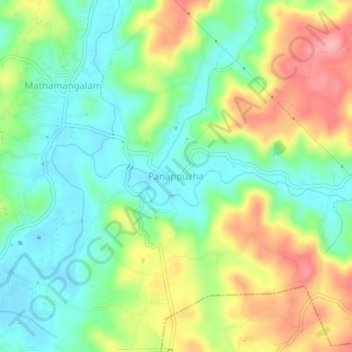
Name: Panappuzha topographic map, elevation, terrain.
Location: Panappuzha, Payyannur Taluk, Kannur, Kerala, 670306, India (12.10422 75.29294 12.14422 75.33294)
Average elevation: 48 m
Minimum elevation: 4 m
Maximum elevation: 117 m
Thank you for supporting this site ❤️
Make a donation
Make a donation
Gear up for your next adventure:
As an Amazon Associate, this site earns from qualifying purchases at no extra cost to you.