
Šahy topographic map
Interactive map
Click on the map to display elevation.
About this map
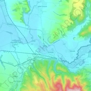
Name: Šahy topographic map, elevation, terrain.
Location: Šahy, Région de Nitra, Západné Slovensko, 936 01, Slovaquie (48.02946 18.90934 48.10946 18.98934)
Average elevation: 177 m
Minimum elevation: 121 m
Maximum elevation: 430 m