
Thank you for supporting this site ❤️
Make a donation
Make a donation
Gear up for your next adventure:
As an Amazon Associate, this site earns from qualifying purchases at no extra cost to you.
Cantugas topographic map
Click on the map to display elevation.
Thank you for supporting this site ❤️
Make a donation
Make a donation
Gear up for your next adventure:
As an Amazon Associate, this site earns from qualifying purchases at no extra cost to you.
About this map
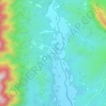
Name: Cantugas topographic map, elevation, terrain.
Location: Cantugas, Mainit, Surigao del Norte, Caraga, Philippines (9.56525 125.45229 9.60525 125.49229)
Average elevation: 187 m
Minimum elevation: 56 m
Maximum elevation: 688 m
Thank you for supporting this site ❤️
Make a donation
Make a donation
Gear up for your next adventure:
As an Amazon Associate, this site earns from qualifying purchases at no extra cost to you.