Geolocate

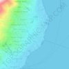
Ternate topographic map

Click on the map to display elevation.

About this map

Name: Ternate topographic map, elevation, terrain.

Location: Ternate, North Maluku, Maluku, Indonesia (0.43272 126.12727 1.35168 127.43990)

Average elevation: 83 m

Minimum elevation: 0 m

Maximum elevation: 1,661 m

Other topographic maps

Click on a map to view its topography, its elevation and its terrain.

Sofifi

Indonesia > North Maluku

Average elevation: 40 m

Bobawa

Indonesia > North Maluku > Halmahera Utara

Average elevation: 169 m

Sofifi

Indonesia > North Maluku

Average elevation: 40 m

Weda

Indonesia > North Maluku > Halmahera Tengah

Average elevation: 45 m

Dukono

Indonesia > North Maluku > Halmahera Utara

Average elevation: 1,033 m

Mandaong

Indonesia > North Maluku > Halmahera Selatan

Average elevation: 29 m

Jailolo

Indonesia > North Maluku > Halmahera Barat

Average elevation: 449 m

Kota

Indonesia > North Maluku > Tidore Islands

Average elevation: 13 m

Kao

Indonesia > North Maluku > Halmahera Utara

Average elevation: 5 m

Mount Gamkonora

Indonesia > North Maluku > Halmahera Barat > Tabobol

Mount Gamkonora is a stratovolcano on Halmahera island, Indonesia. With an elevation of 1,560 metres (5,118 ft), it is the highest peak on the island. It has produced an elongated series of craters along the north–south rift.

Average elevation: 1,113 m

Mare Island

Indonesia > North Maluku > Tidore Islands > Marekofo

Average elevation: 54 m

Weda

Indonesia > North Maluku > Halmahera Tengah

Average elevation: 45 m

Kedi

Indonesia > North Maluku > Halmahera Barat

Average elevation: 290 m

Wawama

Indonesia > North Maluku > Pulau Morotai

Average elevation: 21 m

Mount Ibu

Indonesia > North Maluku > Halmahera Barat

Average elevation: 951 m

Tobelo

Indonesia > North Maluku > Halmahera Utara

Average elevation: 37 m

Pulau Gureda

Indonesia > North Maluku

Average elevation: 0 m

Kota Baru

Indonesia > North Maluku > Ternate

Average elevation: 44 m

Kedi

Indonesia > North Maluku > Halmahera Barat

Average elevation: 290 m

Pulau Ipa

Indonesia > North Maluku > Sula Islands > Desa Leliaba

Average elevation: 20 m

Moti Island

Indonesia > North Maluku > Ternate

Average elevation: 146 m

Gear up for your next adventure:

🎒Backpack Rain Cover - External shield to keep your entire pack dry
🥾All-Terrain Hiking Boots - Versatile boots for varied hiking conditions
🧭GPS Tracker - Track your location in remote areas safely
🔥Camping Stove - Portable stoves to cook outdoors with ease
🧭GPS Outdoor Watch - Smart watch for navigation and fitness tracking in nature

As an Amazon Associate, this site earns from qualifying purchases at no extra cost to you.