Geolocate

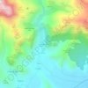
Lago de Babia topographic map

Click on the map to display elevation.

About this map

Name: Lago de Babia topographic map, elevation, terrain.

Location: Lago de Babia, Cabrillanes, León, Castilla y León, España (42.97660 -6.19681 42.97986 -6.19189)

Average elevation: 1,480 m

Minimum elevation: 1,228 m

Maximum elevation: 1,912 m

Other topographic maps

Click on a map to view its topography, its elevation and its terrain.

Peña Chana

España > Castilla y León > Cabrillanes

Average elevation: 1,915 m

Torre de Babia

España > Castilla y León > Cabrillanes

Average elevation: 1,480 m

Mena de Babia

España > Castilla y León > Cabrillanes

Average elevation: 1,362 m

Gear up for your next adventure:

🧥Waterproof Hiking Jacket - Protect yourself from rain and wind while hiking
🧥Thermal Fleece Jacket - Versatile insulation for changing mountain temperatures
🐕Hiking Dog Pack - Let your canine companion carry their own water and food
🔨Vehicle Emergency Tool - Safety tool for remote road trips to trailheads
🛏️Camping Sleeping Mat - Comfortable mats for sleeping outdoors

As an Amazon Associate, this site earns from qualifying purchases at no extra cost to you.