Geolocate

Datal Blao topographic map

Click on the map to display elevation.

About this map

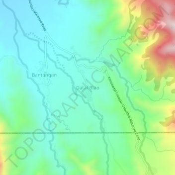
Name: Datal Blao topographic map, elevation, terrain.

Location: Datal Blao, Columbio, Sultan Kudarat, 9801, Philippines (6.56033 124.97869 6.60033 125.01869)

Average elevation: 350 m

Minimum elevation: 189 m

Maximum elevation: 785 m

Gear up for your next adventure:

🔭Compact Monocular - One-handed bird watching and trail spotting
🧥Softshell Jacket - Windproof and breathable jacket for hiking
🧥Packable Rain Jacket - Breathable waterproof layer for unpredictable weather
Camping Coffee Maker - Brew fresh coffee anywhere on the topographic map
🥾Approach Boots - Comfortable boots for hiking and climbing approaches

As an Amazon Associate, this site earns from qualifying purchases at no extra cost to you.