Geolocate

Havixbeck topographic map

Click on the map to display elevation.

Havixbeck

Havixbeck is located on the fringes of the Baumberge, with 187 m the highest elevations of the Münsterland. West of the town emanates the spring of Münstersche Aa which, after passing Münster, converges in the Ems River near Greven.

Wikipedia (CC-BY-SA 3.0)

About this map

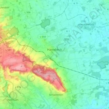
Name: Havixbeck topographic map, elevation, terrain.

Location: Havixbeck, Kreis Coesfeld, North Rhine-Westphalia, 48329, Germany (51.93154 7.36516 52.00959 7.52265)

Average elevation: 96 m

Minimum elevation: 63 m

Maximum elevation: 192 m

Gear up for your next adventure:

🛶Kayak Accessories - Essential gear for safe and fun kayaking adventures
🧦Thermal Socks - Warm socks for winter hiking or camping
🚲Bike Repair Kit - Essential tools for on-trail mechanical issues
🥾Trekking Poles - Adjustable trekking poles to reduce knee stress and improve stability
🥾Hiking Boots - Sturdy boots providing ankle support and traction on rugged trails

As an Amazon Associate, this site earns from qualifying purchases at no extra cost to you.