Geolocate

Fontanelle topographic map

Click on the map to display elevation.

About this map
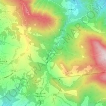
Name: Fontanelle topographic map, elevation, terrain.

Location: Fontanelle, Borgo San Lorenzo, Firenze, Toscana, 50036, Italia (43.85960 11.32699 43.89960 11.36699)

Average elevation: 569 m

Minimum elevation: 308 m

Maximum elevation: 896 m

Gear up for your next adventure:

⛺Backpacking Tent - Lightweight tent for long-distance hiking trips
🕶️Polarized Sunglasses - Reduces glare from snow and water at high elevations
⛺Camping Essentials - All-in-one gear for a comfortable camping trip
📷Outdoor Action Camera - Capture high-elevation views and rugged adventures
👟Trail Running Shoes - Agile footwear for fast-paced topographic exploration

As an Amazon Associate, this site earns from qualifying purchases at no extra cost to you.