Geolocate

Rancasari topographic map

Click on the map to display elevation.

About this map

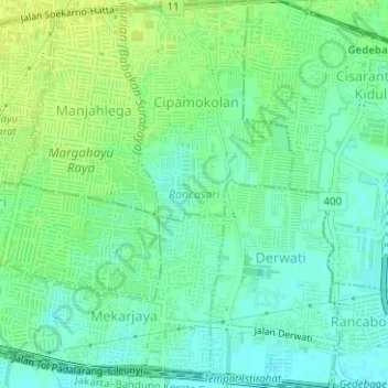
Name: Rancasari topographic map, elevation, terrain.

Location: Rancasari, Bandung, West Java, Java, Indonesia (-6.96910 107.65888 -6.93798 107.68698)

Average elevation: 669 m

Minimum elevation: 661 m

Maximum elevation: 676 m

Other topographic maps

Click on a map to view its topography, its elevation and its terrain.

Sungai penuh sampah

Indonesia > West Java > Bandung > Situ Saeur

Average elevation: 688 m

Gear up for your next adventure:

🧥Ultralight Puffy Jacket - Maximum warmth that packs down to the size of an orange
🥾Approach Shoes - Shoes designed for climbing approaches and rugged trails
🛶Kayak Accessories - Essential gear for safe and fun kayaking adventures
🦶Anti-Blister Balm - Prevents friction and hotspots during long ascents
🥾Waterproof Hiking Boots - Essential footwear for rugged terrain and wet Canadian trails

As an Amazon Associate, this site earns from qualifying purchases at no extra cost to you.