
Thank you for supporting this site ❤️
Make a donation
Make a donation
Gear up for your next adventure:
As an Amazon Associate, this site earns from qualifying purchases at no extra cost to you.
Guaboloma topographic map
Click on the map to display elevation.
Thank you for supporting this site ❤️
Make a donation
Make a donation
Gear up for your next adventure:
As an Amazon Associate, this site earns from qualifying purchases at no extra cost to you.
About this map
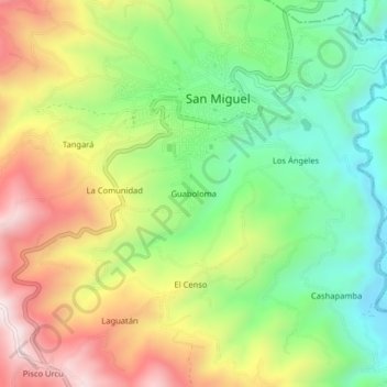
Name: Guaboloma topographic map, elevation, terrain.
Location: Guaboloma, San Miguel, Bolívar, 020301, Ecuador (-1.73812 -79.06468 -1.69812 -79.02468)
Average elevation: 2,549 m
Minimum elevation: 2,249 m
Maximum elevation: 2,940 m
Thank you for supporting this site ❤️
Make a donation
Make a donation
Gear up for your next adventure:
As an Amazon Associate, this site earns from qualifying purchases at no extra cost to you.