Geolocate

Pikes Peak topographic map

Click on the map to display elevation.

About this map

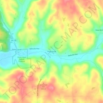
Name: Pikes Peak topographic map, elevation, terrain.

Location: Pikes Peak, Brown County, Indiana, United States (39.10922 -86.16138 39.14922 -86.12138)

Average elevation: 219 m

Minimum elevation: 173 m

Maximum elevation: 263 m

Gear up for your next adventure:

🧥Ultralight Puffy Jacket - Maximum warmth that packs down to the size of an orange
🧊Portable Cooler - Keep food and drinks cold during outdoor adventures
🔦LED Headlamp - Hands-free lighting for early morning starts or late finishes
🧭Orienteering Kit - Tools for map reading and navigation in the wild
🧴Sunscreen SPF - Broad-spectrum sunscreen for outdoor activities

As an Amazon Associate, this site earns from qualifying purchases at no extra cost to you.