Geolocate

Cahil topographic map

Click on the map to display elevation.

About this map

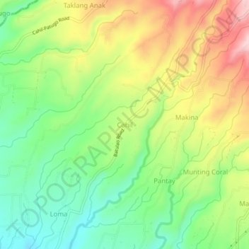
Name: Cahil topographic map, elevation, terrain.

Location: Cahil, Calaca, Batangas, Calabarzon, 4212, Philippines (13.96673 120.78620 14.00673 120.82620)

Average elevation: 179 m

Minimum elevation: 73 m

Maximum elevation: 323 m

Gear up for your next adventure:

🏃Hydration Running Vest - Carry water and maps close to your body for speed
🔋Emergency Crank Radio - Weather alerts and power without needing batteries
🗺️Topographic Maps - Detailed maps to explore trails, mountains, and wilderness areas
🧥Packable Rain Jacket - Breathable waterproof layer for unpredictable weather
🧥Fleece Jacket - Warm and lightweight jacket for layering

As an Amazon Associate, this site earns from qualifying purchases at no extra cost to you.