
Thank you for supporting this site ❤️
Make a donation
Make a donation
Gear up for your next adventure:
As an Amazon Associate, this site earns from qualifying purchases at no extra cost to you.
Liepa topographic map
Click on the map to display elevation.
Thank you for supporting this site ❤️
Make a donation
Make a donation
Gear up for your next adventure:
As an Amazon Associate, this site earns from qualifying purchases at no extra cost to you.
About this map
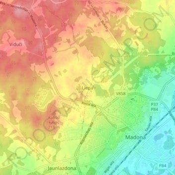
Name: Liepa topographic map, elevation, terrain.
Location: Liepa, Madonas novads, Vidzeme, LV-4801, Latvia (56.84306 26.17833 56.88306 26.21833)
Average elevation: 181 m
Minimum elevation: 122 m
Maximum elevation: 234 m
Thank you for supporting this site ❤️
Make a donation
Make a donation
Gear up for your next adventure:
As an Amazon Associate, this site earns from qualifying purchases at no extra cost to you.