Geolocate

Patalganga topographic map

Click on the map to display elevation.

About this map

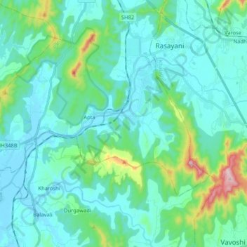
Name: Patalganga topographic map, elevation, terrain.

Location: Patalganga, Apta, Panvel, Raigad, Maharashtra, India (18.80980 73.07157 18.89020 73.23129)

Average elevation: 85 m

Minimum elevation: -1 m

Maximum elevation: 543 m

Gear up for your next adventure:

🎒Hiking Daypack - Lightweight and durable backpacks for day trips and excursions
🔭Compact Monocular - One-handed bird watching and trail spotting
👖Convertible Hiking Pants - Zip-off legs to adapt to changing weather conditions
🧢Outdoor Cap - Protective cap for sun and rain during hikes
🧤Insulated Winter Gloves - Heavy-duty protection for sub-zero Canadian adventures

As an Amazon Associate, this site earns from qualifying purchases at no extra cost to you.