Geolocate

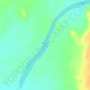
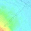
Dendera topographic map

Click on the map to display elevation.

About this map

Name: Dendera topographic map, elevation, terrain.

Location: Dendera, New Valley, Egypt (26.12899 32.61711 26.20899 32.69711)

Average elevation: 78 m

Minimum elevation: 61 m

Maximum elevation: 138 m

Other topographic maps

Click on a map to view its topography, its elevation and its terrain.
Toshka

Egypt > New Valley

Average elevation: 197 m

Toshka Lakes

Egypt > New Valley

Average elevation: 162 m

Toshka

Egypt > New Valley

Average elevation: 194 m

White Desert

Egypt > New Valley

Average elevation: 170 m

Al Khargah City

Egypt > New Valley

Average elevation: 69 m

Toshka

Egypt > New Valley

Average elevation: 196 m

Jouhayna City

Egypt > New Valley

Average elevation: 66 m

Al Khargah City

Egypt > New Valley

Average elevation: 69 m

Gear up for your next adventure:

💧Hydration Pack - Hands-free hydration system for long hikes
🧶550 Survival Paracord - Versatile utility cord for emergency repairs and rigging
🥾Trail Hiking Shoes - Durable shoes designed for rugged trails
🥾Mountain Trail Shoes - High-traction shoes for mountain trails
🧦Hiking Socks - Moisture-wicking and comfortable socks for long hikes

As an Amazon Associate, this site earns from qualifying purchases at no extra cost to you.