
Abbottstown topographic map
Click on the map to display elevation.
About this map
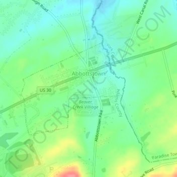
Name: Abbottstown topographic map, elevation, terrain.
Location: Abbottstown, Adams County, Pennsylvania, United States (39.87713 -76.99812 39.89126 -76.97744)
Average elevation: 167 m
Minimum elevation: 142 m
Maximum elevation: 217 m
Other topographic maps
Click on a map to view its topography, its elevation and its terrain.
Raven Rock Mountain
United States > Pennsylvania > Adams County > Liberty Township
Average elevation: 312 m
Gladhill (Greenstone P.O.)
United States > Pennsylvania > Adams County > Hamiltonban Township
Average elevation: 365 m