
Make a donation
Gear up for your next adventure:
As an Amazon Associate, this site earns from qualifying purchases at no extra cost to you.
Deer Horn Island topographic map
Click on the map to display elevation.
Make a donation
Gear up for your next adventure:
As an Amazon Associate, this site earns from qualifying purchases at no extra cost to you.
About this map
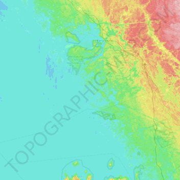
Name: Deer Horn Island topographic map, elevation, terrain.
Average elevation: 199 m
Minimum elevation: 172 m
Maximum elevation: 328 m
Parry Sound District trails, hiking, mountain biking, running and outdoor activities
Make a donation
Gear up for your next adventure:
As an Amazon Associate, this site earns from qualifying purchases at no extra cost to you.
Other topographic maps
Click on a map to view its topography, its elevation and its terrain.
Conger Lake
Canada > Ontario > Parry Sound District > The Archipelago Township
Average elevation: 200 m
Skye Island
Canada > Ontario > Parry Sound District > The Archipelago Township
Average elevation: 191 m