Geolocate

Coldwater topographic map

Click on the map to display elevation.

About this map

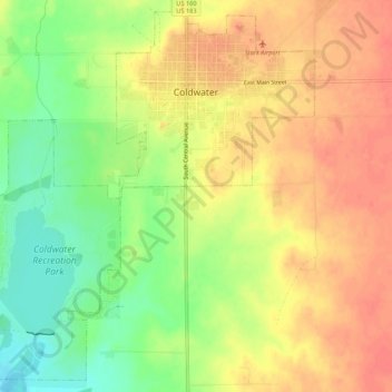
Name: Coldwater topographic map, elevation, terrain.

Location: Coldwater, Comanche County, Kansas, 67029, United States (37.23730 -99.36433 37.27770 -99.31041)

Average elevation: 636 m

Minimum elevation: 604 m

Maximum elevation: 658 m

Gear up for your next adventure:

🪑Insulated Seat Pad - Protect your seat from cold rocks and wet logs
👖Convertible Hiking Pants - Zip-off legs to adapt to changing weather conditions
🛰️Satellite Messenger - Emergency communication for areas with no cell service
🦯Trekking Poles - Reduced impact on joints for steep topographic climbs
🧰Survival Kit - Essential gear for emergencies in the wilderness

As an Amazon Associate, this site earns from qualifying purchases at no extra cost to you.