Geolocate

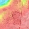
Mitry-Mory topographic map

Click on the map to display elevation.

About this map

Name: Mitry-Mory topographic map, elevation, terrain.

Location: Mitry-Mory, Meaux, Seine-et-Marne, Ile-de-France, Metropolitan France, 77290, France (48.95028 2.56223 49.00890 2.66096)

Average elevation: 77 m

Minimum elevation: 48 m

Maximum elevation: 122 m

Other topographic maps

Click on a map to view its topography, its elevation and its terrain.

E

France > Ile-de-France > Seine-et-Marne > Limoges-Fourches

Average elevation: 91 m

Le Tillet

France > Ile-de-France > Seine-et-Marne > Reuil-en-Brie

Average elevation: 117 m

Parc du Moulin

France > Ile-de-France > Seine-et-Marne > Chelles

Average elevation: 44 m

Freebooter Falls

France > Ile-de-France > Seine-et-Marne > Chessy

Average elevation: 117 m

Gear up for your next adventure:

🥾Trail Running Shoes - Lightweight and durable shoes for trail running
🧦Merino Wool Socks - Moisture-wicking comfort for long-distance hiking
🚑Survival Whistle - Signal for help across long distances in mountains
🧥Waterproof Hiking Jacket - Protect yourself from rain and wind while hiking
💡LED Headlamp - Hands-free illumination for night hiking and camping

As an Amazon Associate, this site earns from qualifying purchases at no extra cost to you.