Geolocate

Dispur topographic map

Click on the map to display elevation.

About this map
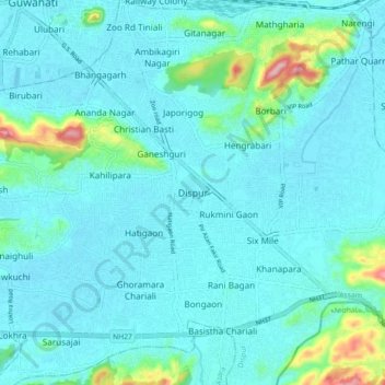
Name: Dispur topographic map, elevation, terrain.

Location: Dispur, Kamrup Metropolitan, Assam, 781005, India (26.10094 91.75103 26.18094 91.83103)

Average elevation: 78 m

Minimum elevation: 48 m

Maximum elevation: 273 m

Gear up for your next adventure:

🧣Merino Neck Gaiter - Protects against wind, sun, and cold at high altitudes
🧤Insulated Winter Gloves - Heavy-duty protection for sub-zero Canadian adventures
🥾Waterproof Hiking Boots - Essential footwear for rugged terrain and wet Canadian trails
🩹Moleskin Blister Pads - Direct protection for painful foot pressure points
👟Sport Hiking Sandals - Breathable footwear for water crossings and camp rest

As an Amazon Associate, this site earns from qualifying purchases at no extra cost to you.