Geolocate

Kowthalam topographic map

Click on the map to display elevation.

About this map

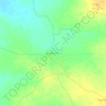
Name: Kowthalam topographic map, elevation, terrain.

Location: Kowthalam, Kurnool District, Andhra Pradesh, 518344, India (15.75424 77.11852 15.79424 77.15852)

Average elevation: 377 m

Minimum elevation: 363 m

Maximum elevation: 390 m

Gear up for your next adventure:

💡LED Camping Lantern - Illuminate your campsite with long-lasting lanterns
👟Leg Gaiters - Keep debris, mud, and snow out of your boots
🥾Mountain Trail Shoes - High-traction shoes for mountain trails
🥾Mountain Hiking Boots - High-traction boots for rocky terrain
🥾Trekking Boots - Durable boots for long-distance trekking

As an Amazon Associate, this site earns from qualifying purchases at no extra cost to you.