Geolocate

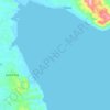
Biga topographic map

Click on the map to display elevation.

About this map

Name: Biga topographic map, elevation, terrain.

Location: Biga, Calatagan, Batangas, Calabarzon, 4215, Philippines (13.88450 120.62858 13.92450 120.66858)

Average elevation: 45 m

Minimum elevation: 4 m

Maximum elevation: 132 m

Other topographic maps

Click on a map to view its topography, its elevation and its terrain.
Burot Beach

Philippines > Batangas > Calatagan

Average elevation: 3 m

Pagapas Bay

Philippines > Batangas > Calatagan

Average elevation: 15 m

Gear up for your next adventure:

🧭GPS Outdoor Watch - Smart watch for navigation and fitness tracking in nature
🔋Lithium AA Batteries - Long-lasting power that performs in extreme cold
🕶️Polarized Sunglasses - Reduces glare from snow and water at high elevations
🥾Hiking Shorts - Breathable shorts suitable for summer hikes
🧥Waterproof Jacket - Lightweight rain jackets for hiking and outdoor activities

As an Amazon Associate, this site earns from qualifying purchases at no extra cost to you.