Geolocate

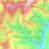
Gauri Sankar topographic map

Click on the map to display elevation.

About this map

Name: Gauri Sankar topographic map, elevation, terrain.

Location: Gauri Sankar, Gaurishankar, Dolakha, Bagamati Province, Nepal (27.96730 86.33445 27.96740 86.33455)

Average elevation: 5,942 m

Minimum elevation: 5,080 m

Maximum elevation: 7,093 m

Other topographic maps

Click on a map to view its topography, its elevation and its terrain.
Kalinchok

Nepal > Bagamati Province > Dolakha

Average elevation: 2,058 m

Bhimeshwor

Nepal > Bagamati Province > Dolakha

Average elevation: 1,992 m

Jiri

Nepal > Bagamati Province > Dolakha

Average elevation: 2,496 m

Tsho Rolpa Lake

Nepal > Bagamati Province > Dolakha

Tsho Rolpa (also Cho Rolpa) is one of the biggest glacial lakes in Nepal. The lake, which is located at an altitude of 4,580 metres (15,030 ft) in the Rolwaling Valley, Dolakha District, has grown considerably over the last 50 years due to glacial melting in the Himalayas.

Average elevation: 4,897 m
Gaurishankar

Nepal > Bagamati Province > Dolakha

Average elevation: 3,622 m

Baiteshwor

Nepal > Bagamati Province > Dolakha

Average elevation: 1,710 m

Bigu

Nepal > Bagamati Province > Dolakha

Average elevation: 3,913 m

Bhimeshwor

Nepal > Bagamati Province > Dolakha

Average elevation: 1,992 m

Gear up for your next adventure:

👟Leg Gaiters - Keep debris, mud, and snow out of your boots
🧥Softshell Hiking Jacket - The perfect balance of wind protection and breathability
🧤Thermal Hiking Gloves - Grip-enhanced gloves for cold-weather altitude trekking
🥾Trail Hiking Boots - Supportive boots for rough trails
🥤Collapsible Travel Cup - Saves space and weight in your mess kit

As an Amazon Associate, this site earns from qualifying purchases at no extra cost to you.