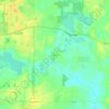
Kenosha topographic map
Click on the map to display elevation.
About this map

Name: Kenosha topographic map, elevation, terrain.
Location: Kenosha, Kenosha County, Wisconsin, United States (42.53885 -87.99698 42.63935 -87.80759)
Average elevation: 190 m
Minimum elevation: 174 m
Maximum elevation: 230 m
Other topographic maps
Click on a map to view its topography, its elevation and its terrain.

Richard Bong State Recreation Area
United States > Wisconsin > Kenosha County > Town of Brighton > Brighton
Average elevation: 245 m