Geolocate

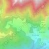
Banni topographic map

Click on the map to display elevation.

About this map

Name: Banni topographic map, elevation, terrain.

Location: Banni, Dharamshala, Kangra, Himachal Pradesh, 176057, India (32.15717 76.35530 32.19717 76.39530)

Average elevation: 1,156 m

Minimum elevation: 941 m

Maximum elevation: 1,676 m

Other topographic maps

Click on a map to view its topography, its elevation and its terrain.
Kareri

India > Himachal Pradesh > Dharamshala

Average elevation: 1,849 m

Balh

India > Himachal Pradesh > Dharamshala > Dharamshala

Average elevation: 1,906 m

Kareri

India > Himachal Pradesh > Dharamshala

Average elevation: 1,849 m

Kareri

India > Himachal Pradesh > Dharamshala

Average elevation: 1,849 m

Gear up for your next adventure:

🦟Insect Repellent - Keep mosquitoes and black flies away in wooded areas
🐕Hiking Dog Pack - Let your canine companion carry their own water and food
🧴Insect Repellent - Protect yourself from bugs during outdoor adventures
🧭GPS Outdoor Watch - Smart watch for navigation and fitness tracking in nature
🧰Survival Kit - Essential gear for emergencies in the wilderness

As an Amazon Associate, this site earns from qualifying purchases at no extra cost to you.