Geolocate

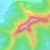
Malhargad topographic map

Click on the map to display elevation.

About this map

Name: Malhargad topographic map, elevation, terrain.

Location: Malhargad, Purandhar, Pune District, Maharashtra, India (18.41196 74.04930 18.41206 74.04940)

Average elevation: 824 m

Minimum elevation: 652 m

Maximum elevation: 984 m

Other topographic maps

Click on a map to view its topography, its elevation and its terrain.
Purandar Fort

India > Maharashtra > Purandhar > Narayanpur

Average elevation: 1,027 m

Purandar Fort

India > Maharashtra > Purandhar > Narayanpur

Average elevation: 1,027 m

Gear up for your next adventure:

🥾Mountain Hiking Boots - High-traction boots for rocky terrain
🌬️Windproof Camp Stove - Efficient cooking even on exposed mountain peaks
🔦LED Headlamp - Hands-free lighting for early morning starts or late finishes
🛌Insulated Sleeping Pad - Critical thermal barrier between you and the cold ground
🕶️Polarized Sunglasses - Protect your eyes with durable polarized lenses

As an Amazon Associate, this site earns from qualifying purchases at no extra cost to you.