Geolocate

Pichanaki topographic map

Click on the map to display elevation.

About this map

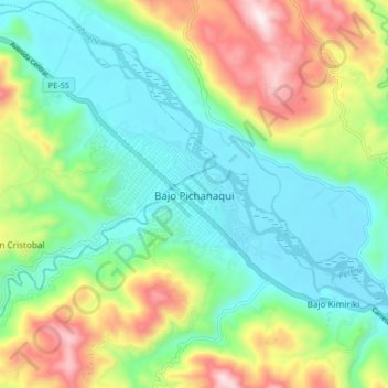
Name: Pichanaki topographic map, elevation, terrain.

Location: Pichanaki, Provincia de Chanchamayo, Junín, Perú (-10.94823 -74.89263 -10.90823 -74.85263)

Average elevation: 572 m

Minimum elevation: 476 m

Maximum elevation: 1,024 m

Gear up for your next adventure:

🧰Survival Kit - Essential gear for emergencies in the wilderness
🧴First Aid Kit - Essential first aid supplies for outdoor emergencies
🎒Backpack Rain Cover - External shield to keep your entire pack dry
🧥Packable Rain Jacket - Breathable waterproof layer for unpredictable weather
🥾Trail Hiking Socks - Comfortable socks to prevent blisters and fatigue

As an Amazon Associate, this site earns from qualifying purchases at no extra cost to you.