
Begun topographic map
Click on the map to display elevation.
Begun
Begun is located at 24°59′N 75°00′E / 24.98°N 75.0°E / 24.98; 75.0. It has an average elevation of 412 metres (1351 feet). Begun has very good soil for agriculture. In Begun Tehsil there are two famous places: Jogania Mata and Menal. Jogania Mata Temple is situated at the top of the mountains. It is 20 km from Begun. Jogania Mata Temple is a famous in the Chittorgarh district. Menal is near Jogania Mata. It is 25 km from Begun. Begun is a good tourist place and a very good fort situated nearby named as Nahargarh.
About this map
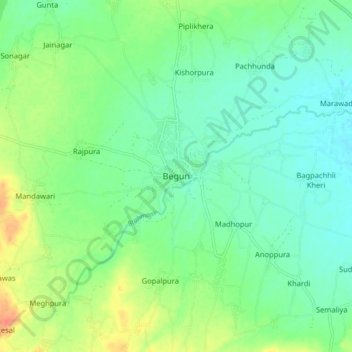
Name: Begun topographic map, elevation, terrain.
Average elevation: 422 m
Minimum elevation: 407 m
Maximum elevation: 452 m