Geolocate

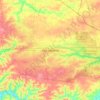
Woodlawn topographic map

Click on the map to display elevation.

About this map

Name: Woodlawn topographic map, elevation, terrain.

Location: Woodlawn, Montgomery County, Middle Tennessee, Tennessee, 37191, United States (36.52417 -87.53076 36.56417 -87.49076)

Average elevation: 185 m

Minimum elevation: 152 m

Maximum elevation: 199 m

Other topographic maps

Click on a map to view its topography, its elevation and its terrain.

Lake Taal

United States > Tennessee > Montgomery County

Average elevation: 165 m

Gear up for your next adventure:

🧼Travel Hand Sanitizer - Keep hands clean when water is scarce
👖Convertible Hiking Pants - Zip-off legs to adapt to changing weather conditions
🦌Outdoor Trail Camera - Monitor wildlife activity near your favorite spots
🧥Waterproof Pants - Keep dry during rainy hiking conditions
🌡️Emergency Mylar Blankets - Compact thermal protection for unexpected nights outdoors

As an Amazon Associate, this site earns from qualifying purchases at no extra cost to you.