Geolocate

Hochstadt topographic map

Click on the map to display elevation.

About this map

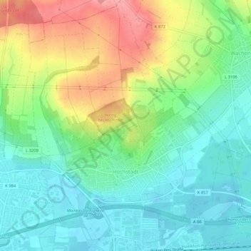
Name: Hochstadt topographic map, elevation, terrain.

Location: Hochstadt, Maintal, Main-Kinzig-Kreis, Hesse, 63477, Germany (50.14267 8.81296 50.17578 8.85703)

Average elevation: 136 m

Minimum elevation: 98 m

Maximum elevation: 205 m

Gear up for your next adventure:

🧰Survival Kit - Essential gear for emergencies in the wilderness
Camping Groundsheet - Protect your tent from moisture and dirt
🧴Outdoor Sunscreen - High SPF protection for high-altitude UV exposure
🌬️Windproof Camp Stove - Efficient cooking even on exposed mountain peaks
💡Portable Camping Lamp - Rechargeable lamp for campsite lighting

As an Amazon Associate, this site earns from qualifying purchases at no extra cost to you.