Geolocate

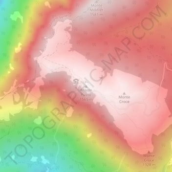
Monte Pizzoc topographic map

Click on the map to display elevation.

Monte Pizzoc

Pizzoc is a mountain of the Veneto, Italy. It has an elevation of 1,565 metres.

Wikipedia (CC-BY-SA 3.0)

About this map

Name: Monte Pizzoc topographic map, elevation, terrain.

Location: Monte Pizzoc, Fregona, Province of Treviso, Veneto, 31010, Italy (46.04040 12.34701 46.04050 12.34711)

Average elevation: 1,240 m

Minimum elevation: 566 m

Maximum elevation: 1,562 m

Gear up for your next adventure:

☕Camping Coffee Maker - Brew fresh coffee anywhere on the topographic map
🧊Portable Cooler - Keep food and drinks cold during outdoor adventures
🧦Hiking Liner Socks - Thin base layer to prevent friction and blisters
🧊Insulated Water Bottle - Keeps drinks cold in summer and prevents freezing in winter
🚲Handlebar Phone Mount - View topographic-map.com live while cycling

As an Amazon Associate, this site earns from qualifying purchases at no extra cost to you.