
Mount Rushmore topographic map
Interactive map
Click on the map to display elevation.
About this map
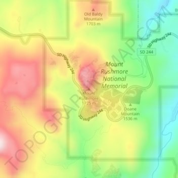
Name: Mount Rushmore topographic map, elevation, terrain.
Average elevation: 1,562 m
Minimum elevation: 1,367 m
Maximum elevation: 1,766 m
Other topographic maps
Click on a map to view its topography, its elevation and its terrain.
Rapid City
États-Unis d'Amérique > Dakota du Sud > Pennington County
Rapid City, Pennington County, Dakota du Sud, États-Unis d'Amérique
Average elevation: 1,067 m