Geolocate

Jia topographic map

Click on the map to display elevation.

About this map

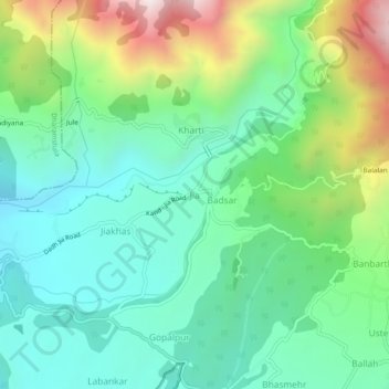
Name: Jia topographic map, elevation, terrain.

Location: Jia, Palampur, Kangra, Himachal Pradesh, 176059, India (32.13828 76.43751 32.17828 76.47751)

Average elevation: 1,446 m

Minimum elevation: 1,132 m

Maximum elevation: 2,199 m

Gear up for your next adventure:

🧰Multitool Knife - Compact and versatile tool for outdoor use
👟Leg Gaiters - Keep debris, mud, and snow out of your boots
🧥Waterproof Hiking Jacket - Protect yourself from rain and wind while hiking
🦯Trekking Poles - Reduced impact on joints for steep topographic climbs
🧣Evaporative Cooling Towel - Beat the heat during intense summer climbs

As an Amazon Associate, this site earns from qualifying purchases at no extra cost to you.