
Thank you for supporting this site ❤️
Make a donation
Make a donation
Gear up for your next adventure:
As an Amazon Associate, this site earns from qualifying purchases at no extra cost to you.
Torneira topographic map
Click on the map to display elevation.
Thank you for supporting this site ❤️
Make a donation
Make a donation
Gear up for your next adventure:
As an Amazon Associate, this site earns from qualifying purchases at no extra cost to you.
About this map
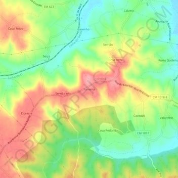
Name: Torneira topographic map, elevation, terrain.
Location: Torneira, Louriçal, Pombal, Leiria, 3090-811, Portugal (40.01909 -8.78954 40.05909 -8.74954)
Average elevation: 54 m
Minimum elevation: -2 m
Maximum elevation: 116 m
Thank you for supporting this site ❤️
Make a donation
Make a donation
Gear up for your next adventure:
As an Amazon Associate, this site earns from qualifying purchases at no extra cost to you.