Geolocate

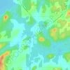
Rouyn topographic map

Click on the map to display elevation.

About this map

Name: Rouyn topographic map, elevation, terrain.

Location: Rouyn, Rouyn-Noranda, Abitibi-Témiscamingue, Quebec, Canada (48.20605 -79.08351 48.25356 -78.95222)

Average elevation: 297 m

Minimum elevation: 267 m

Maximum elevation: 373 m

Quebec trails, hiking, mountain biking, running and outdoor activities

Other topographic maps

Click on a map to view its topography, its elevation and its terrain.
Lac Labyrinthe

Canada > Quebec > Rouyn-Noranda

Average elevation: 291 m

Rollet

Canada > Quebec > Rouyn-Noranda

Average elevation: 276 m

Lac Brunet

Canada > Quebec > Rouyn-Noranda

Average elevation: 391 m

Gear up for your next adventure:

🧢Hiking Hat - Sun-protective and breathable hats for long treks
🪑Ultralight Camping Stool - Compact seating for rest stops during long hikes
🚲Heavy Duty Bike Lock - Secure your bike at the trailhead or during stops
🧭Orienteering Kit - Tools for map reading and navigation in the wild
🔦LED Headtorch - Bright and durable light for night activities

As an Amazon Associate, this site earns from qualifying purchases at no extra cost to you.