
Thank you for supporting this site ❤️
Make a donation
Make a donation
Gear up for your next adventure:
As an Amazon Associate, this site earns from qualifying purchases at no extra cost to you.
Ostróda topographic map
Click on the map to display elevation.
Thank you for supporting this site ❤️
Make a donation
Make a donation
Gear up for your next adventure:
As an Amazon Associate, this site earns from qualifying purchases at no extra cost to you.
About this map
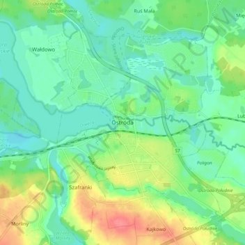
Name: Ostróda topographic map, elevation, terrain.
Location: Ostróda, Ostróda County, Warmian-Masurian Voivodeship, Poland (53.68095 19.90583 53.72461 20.00015)
Average elevation: 106 m
Minimum elevation: 84 m
Maximum elevation: 154 m
Thank you for supporting this site ❤️
Make a donation
Make a donation
Gear up for your next adventure:
As an Amazon Associate, this site earns from qualifying purchases at no extra cost to you.