Geolocate

Lerate topographic map

Click on the map to display elevation.

About this map
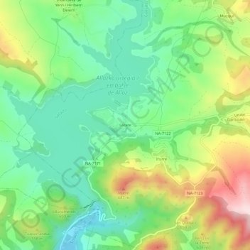
Name: Lerate topographic map, elevation, terrain.

Location: Lerate, Guesálaz, Tierra Estella, Navarra, 31291, España (42.69854 -1.95533 42.73854 -1.91533)

Average elevation: 527 m

Minimum elevation: 397 m

Maximum elevation: 757 m

Gear up for your next adventure:

💡Portable Camping Lamp - Rechargeable lamp for campsite lighting
🥤Collapsible Travel Cup - Saves space and weight in your mess kit
🥾Waterproof Hiking Shoes - Durable shoes for wet and rugged trails
🔦UV Flashlight - Detect minerals or specific insects in the dark
⛺Camping Groundsheet - Protect your tent from moisture and dirt

As an Amazon Associate, this site earns from qualifying purchases at no extra cost to you.