Geolocate

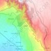
Kamburu ward topographic map

Click on the map to display elevation.

About this map

Name: Kamburu ward topographic map, elevation, terrain.

Location: Kamburu ward, Lari, Kiambu, Kenya (-1.05263 36.68383 -1.00588 36.80737)

Average elevation: 2,040 m

Minimum elevation: 1,753 m

Maximum elevation: 2,355 m

Other topographic maps

Click on a map to view its topography, its elevation and its terrain.

Kijabe

Kenya > Kiambu > Lari > Kinale ward

It stands on the edge of the Great Rift Valley at an altitude of 2200m, some 50 kilometres north-west of Nairobi. Kijabe is located in the sub-county of Lari, Kiambu County. Kijabe has a population 2,026 in 2019. Kijabe has a railway station along the Uganda Railway. The town is located between Limuru and…

Average elevation: 2,311 m

Nyanduma

Kenya > Kiambu > Lari > Nyanduma ward

Average elevation: 2,177 m

Kijabe

Kenya > Kiambu > Lari > Kijabe ward

Average elevation: 2,233 m

Escarpment

Kenya > Kiambu > Lari > Lari/Kirenya ward

Average elevation: 2,237 m

Kimende

Kenya > Kiambu > Lari > Kijabe ward

Average elevation: 2,346 m

Kijabe

Kenya > Kiambu > Lari > Kijabe ward

Average elevation: 2,233 m

Escarpment

Kenya > Kiambu > Lari > Lari/Kirenya ward

Average elevation: 2,237 m

Nyanduma Ward

Kenya > Kiambu > Lari

Average elevation: 2,136 m

Gear up for your next adventure:

🩹Moleskin Blister Pads - Direct protection for painful foot pressure points
🧶550 Survival Paracord - Versatile utility cord for emergency repairs and rigging
🧤Insulated Winter Gloves - Heavy-duty protection for sub-zero Canadian adventures
☕Camping Coffee Maker - Brew fresh coffee anywhere on the topographic map
🧥Thermal Layer - Insulating layer for cold outdoor conditions

As an Amazon Associate, this site earns from qualifying purchases at no extra cost to you.