Geolocate

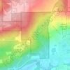
Reedsburg topographic map

Click on the map to display elevation.

About this map
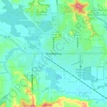
Name: Reedsburg topographic map, elevation, terrain.

Location: Reedsburg, Sauk County, Wisconsin, United States (43.50531 -90.03562 43.55953 -89.95470)

Average elevation: 281 m

Minimum elevation: 261 m

Maximum elevation: 359 m

Other topographic maps

Click on a map to view its topography, its elevation and its terrain.
Hill Point

United States > Wisconsin > Sauk County

Average elevation: 331 m

Cassell

United States > Wisconsin > Sauk County

Average elevation: 238 m

Gear up for your next adventure:

🎒Backpack Rain Cover - External shield to keep your entire pack dry
🧴Bear Spray Holster - Quick-access carry for essential Canadian wilderness safety
🧳Compression Sacks - Maximize space in your backpack by shrinking gear
🎒Hiking Backpack - Lightweight and ergonomic backpacks for day hikes or multi-day treks
🏃Hydration Running Vest - Carry water and maps close to your body for speed

As an Amazon Associate, this site earns from qualifying purchases at no extra cost to you.