
Thank you for supporting this site ❤️
Make a donation
Make a donation
Gear up for your next adventure:
As an Amazon Associate, this site earns from qualifying purchases at no extra cost to you.
Singa topographic map
Click on the map to display elevation.
Thank you for supporting this site ❤️
Make a donation
Make a donation
Gear up for your next adventure:
As an Amazon Associate, this site earns from qualifying purchases at no extra cost to you.
About this map
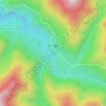
Name: Singa topographic map, elevation, terrain.
Location: Singa, Singa Circle, Upper Siang, Arunachal Pradesh, India (28.81396 95.18197 28.82297 95.19020)
Average elevation: 1,674 m
Minimum elevation: 1,409 m
Maximum elevation: 2,097 m
Thank you for supporting this site ❤️
Make a donation
Make a donation
Gear up for your next adventure:
As an Amazon Associate, this site earns from qualifying purchases at no extra cost to you.