
Bernville topographic map
Click on the map to display elevation.
Bernville
Northkill Creek feeds into Blue Marsh Lake, and the Blue Marsh slackwater is federal property. Hence a portion of Bernville is part of the Blue Marsh system. Blue Marsh Lake is a popular recreation site, offering hiking, boating, and fishing. The lake is also important for water supply, flood control, and wildlife habitat. A levee along Northkill Creek protects Bernville from Blue Marsh flooding above 300 feet (91 m) elevation.
About this map
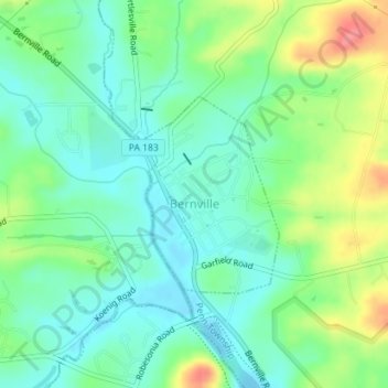
Name: Bernville topographic map, elevation, terrain.
Location: Bernville, Berks County, Pennsylvania, United States (40.42719 -76.11685 40.44091 -76.10441)
Average elevation: 113 m
Minimum elevation: 87 m
Maximum elevation: 168 m
Other topographic maps
Click on a map to view its topography, its elevation and its terrain.
Dale
United States > Pennsylvania > Berks County > Washington Township > Dale
Average elevation: 236 m