
Thank you for supporting this site ❤️
Make a donation
Make a donation
Gear up for your next adventure:
As an Amazon Associate, this site earns from qualifying purchases at no extra cost to you.
Razamonde topographic map
Click on the map to display elevation.
Thank you for supporting this site ❤️
Make a donation
Make a donation
Gear up for your next adventure:
As an Amazon Associate, this site earns from qualifying purchases at no extra cost to you.
About this map
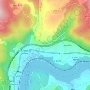
Name: Razamonde topographic map, elevation, terrain.
Location: Razamonde, Cenlle, O Ribeiro, Ourense, Galicia, 32459, Spain (42.32448 -8.08080 42.34473 -8.04151)
Average elevation: 215 m
Minimum elevation: 88 m
Maximum elevation: 452 m
Thank you for supporting this site ❤️
Make a donation
Make a donation
Gear up for your next adventure:
As an Amazon Associate, this site earns from qualifying purchases at no extra cost to you.